

The Dales 30

Great Whernside
8 miles / 13km
Location: Yorkshire Dales
Enjoy some of the best views in the Yorkshire Dales, especially on the summit ridge
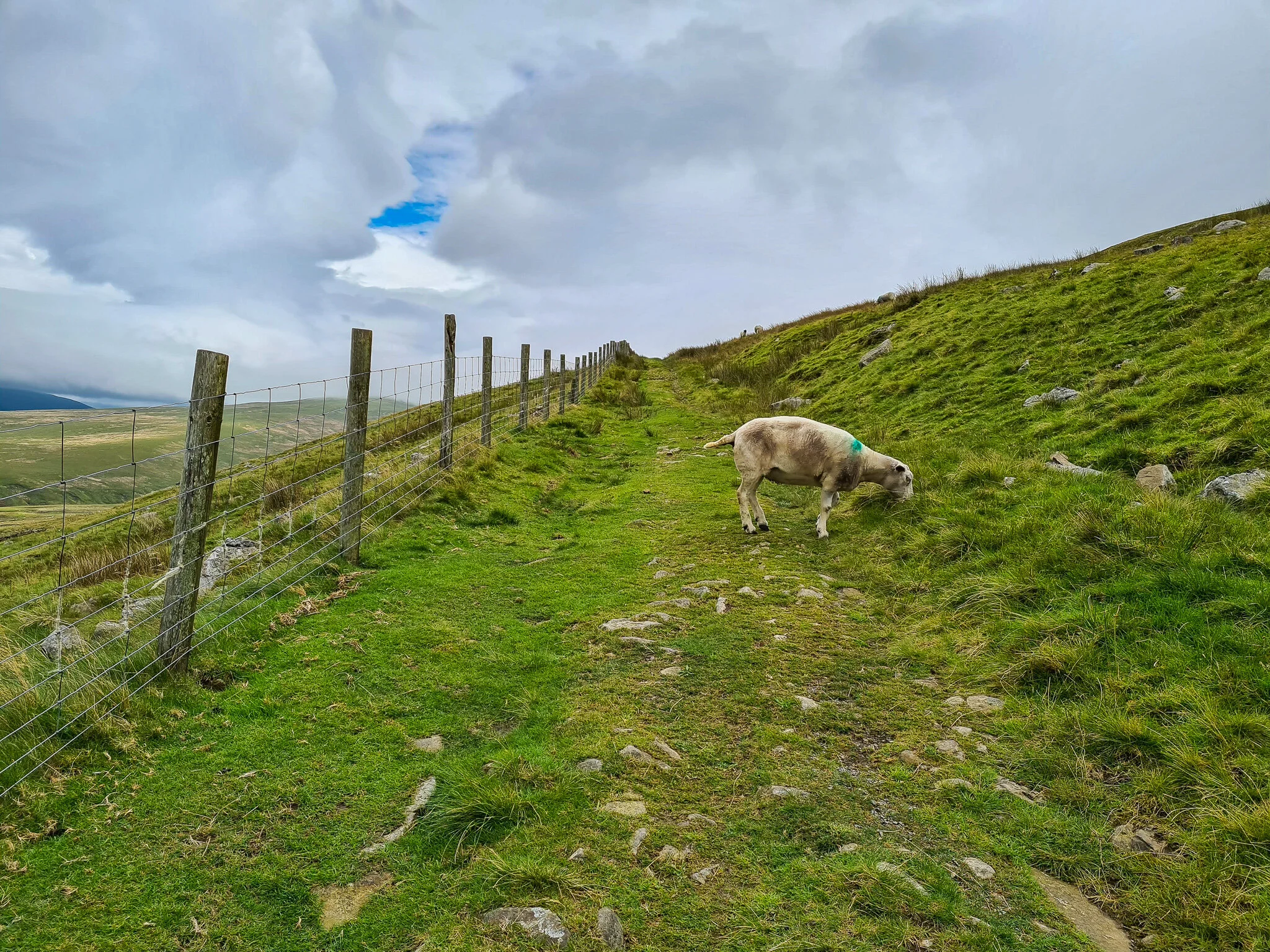
Contributing to part of the Dales 30, Great Whernside is one of many mountains in upper Wharfedale, starting and finishing in the modest village of Kettlewell. Although the route can be challenging on foot in parts, as the terrain is slightly rougher. This makes for an excellent microadventure high up in the fells of the Yorkshire Dales.
It was New Year’s Eve, almost a year of being in a global pandemic, and hoping 2021 would be a better year for the world. We decided on ending 2020 by enjoying the simplicity of the great outdoors, and a chance to disconnect from social media and reconnect with nature.

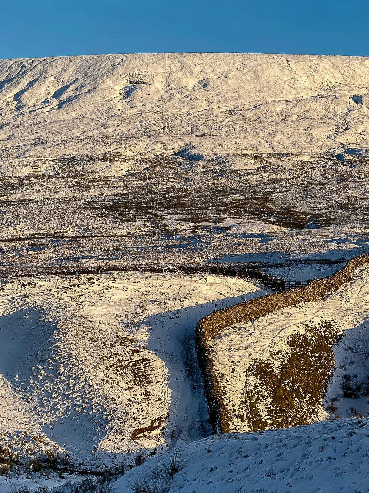
Upon arrival towards Kettlewell, the fog was very low in the valley and we both looked at each other thinking, “oh well this is going to be interesting? We’re not going to see a thing, are we?” Suddenly the fog cleared, snowy peaks greeted us with crystal blue skies. It seemed to have accumulated only on the south side of the Dales, lucky for us, as we both sat there smiling with excitement itching to explore the idyllic Yorkshire Dales. We began the hike from the main car park in Kettlewell, here, we walked through the sleeping town and made our way east onto the winding slow-rising path towards Hag Dyke. As we climbed higher, picturesque views of nearby fells came into sight, covered in a light dusting of snow and pockets of fluffy clouds that loomed over. The captivating views lifted our hearts and made our souls sing, it was eerily peaceful.


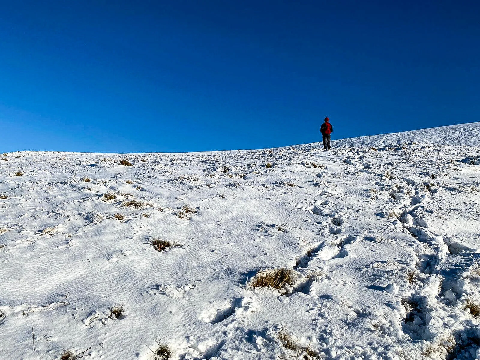
The higher we climbed, the heavier the snow was beneath, paths became less visible, and it was proving to be difficult to navigate. Needless to say, we were still enjoying ourselves roaming the wind-swept landscape. I could see the plateau of the flat summit, but how were we going to get there, there wasn’t a path. “I think we need to go up there?” As I followed directions on my watch. “Are you sure? It’s dangerous this!” The snow became deeper, the terrain became steeper, the clouds were coming in and I couldn’t help but think to myself, this is amazing! We are completely cut off from the world up here!

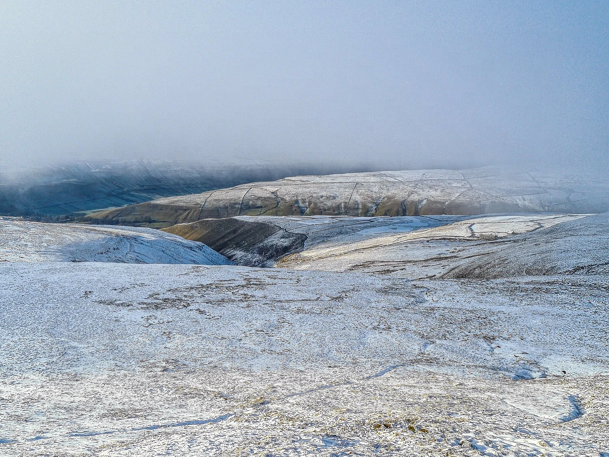
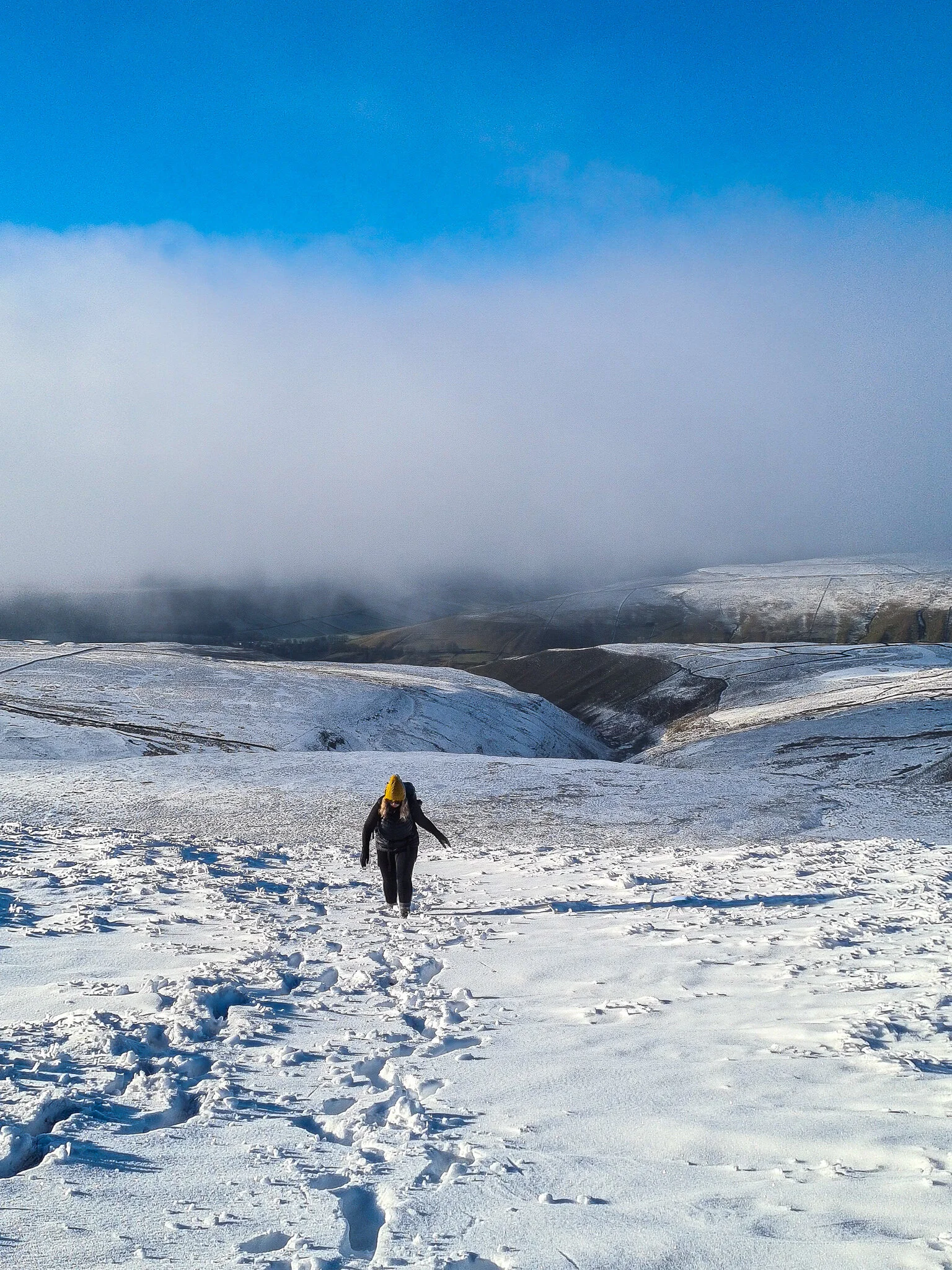

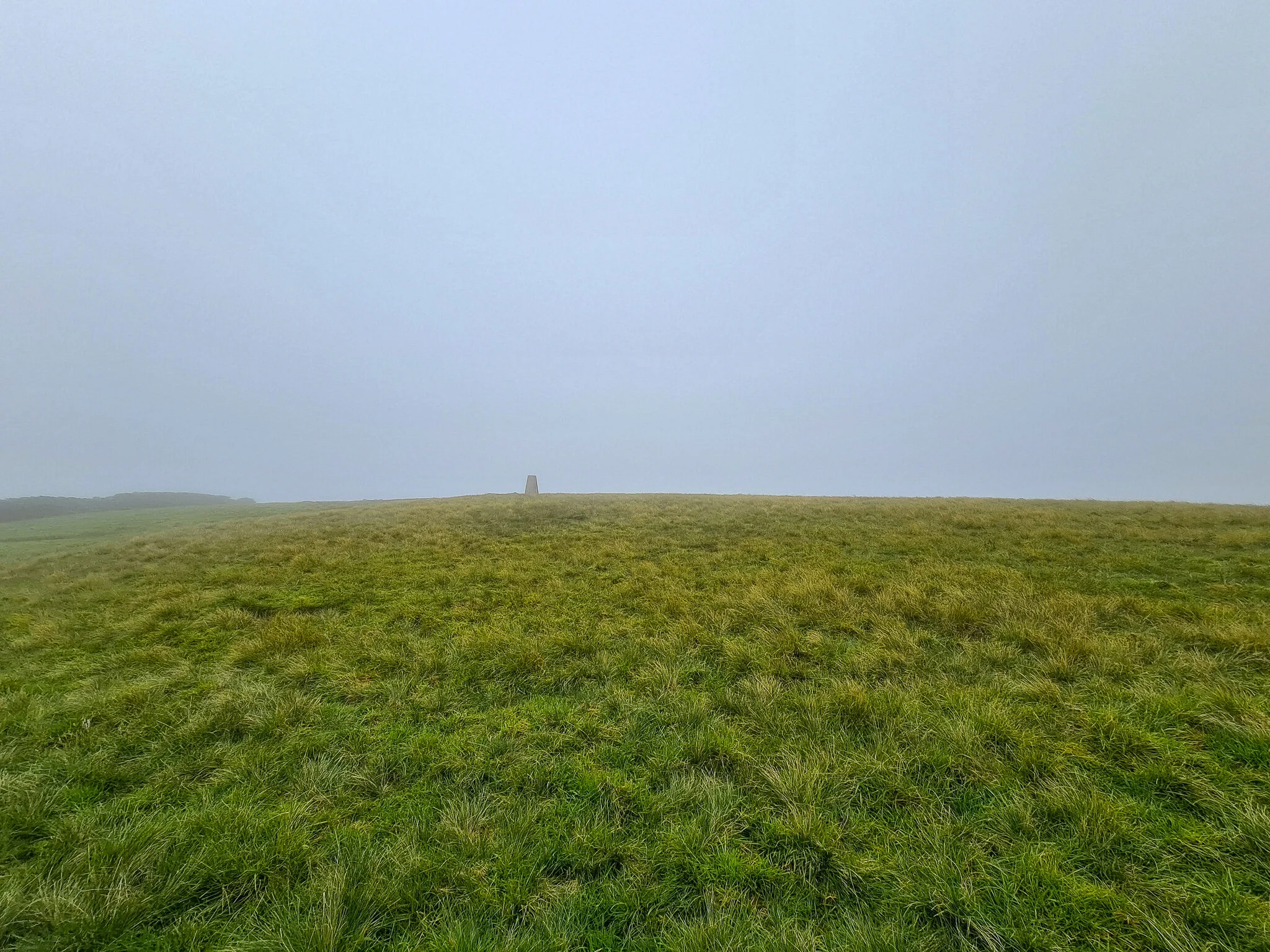
As we emerged onto the plateau, we were above the clouds but could see they were moving in fast. The expansive flat section was guided with tracks from other hikers, and led to the summit of a boulder field, taking us to the trig point of Great Whernside. However, we were submerged in thick cloud making views non-existent. Whilst sitting there having our soup, at the blink of an eye the cloud cleared, suddenly we were captivated with an outstanding view of cloud inversion. A sense of euphoria filled us.
Onwards, as the path leaves the ridge, we descended sharply on what would normally have been very wet was extremely icy, and therefore we had to be very cautious. During our descent, the sun sat in the clouds and created an almost eclipse effect which had us in awe as we gazed into the twilight. Following this, we made our way to the final, and probably my most enjoyable part of the hike along the old mining tracks towards Top Mere Road. As the sun set, it created the most spellbinding, shades of pink over the white fells, merging into a golden orange that set into dusk above the misty valley below. The tranquillity and silence felt almost spiritual, as we meandered our way back into Kettlewell.


It was the perfect way to end the year and will stay with me forever!


Hidden Valleys of Wharfedale
13 miles / 20 km
Location: Yorkshire Dales
Venture through the remote u-shape valley onto Yokenthwaite Moor
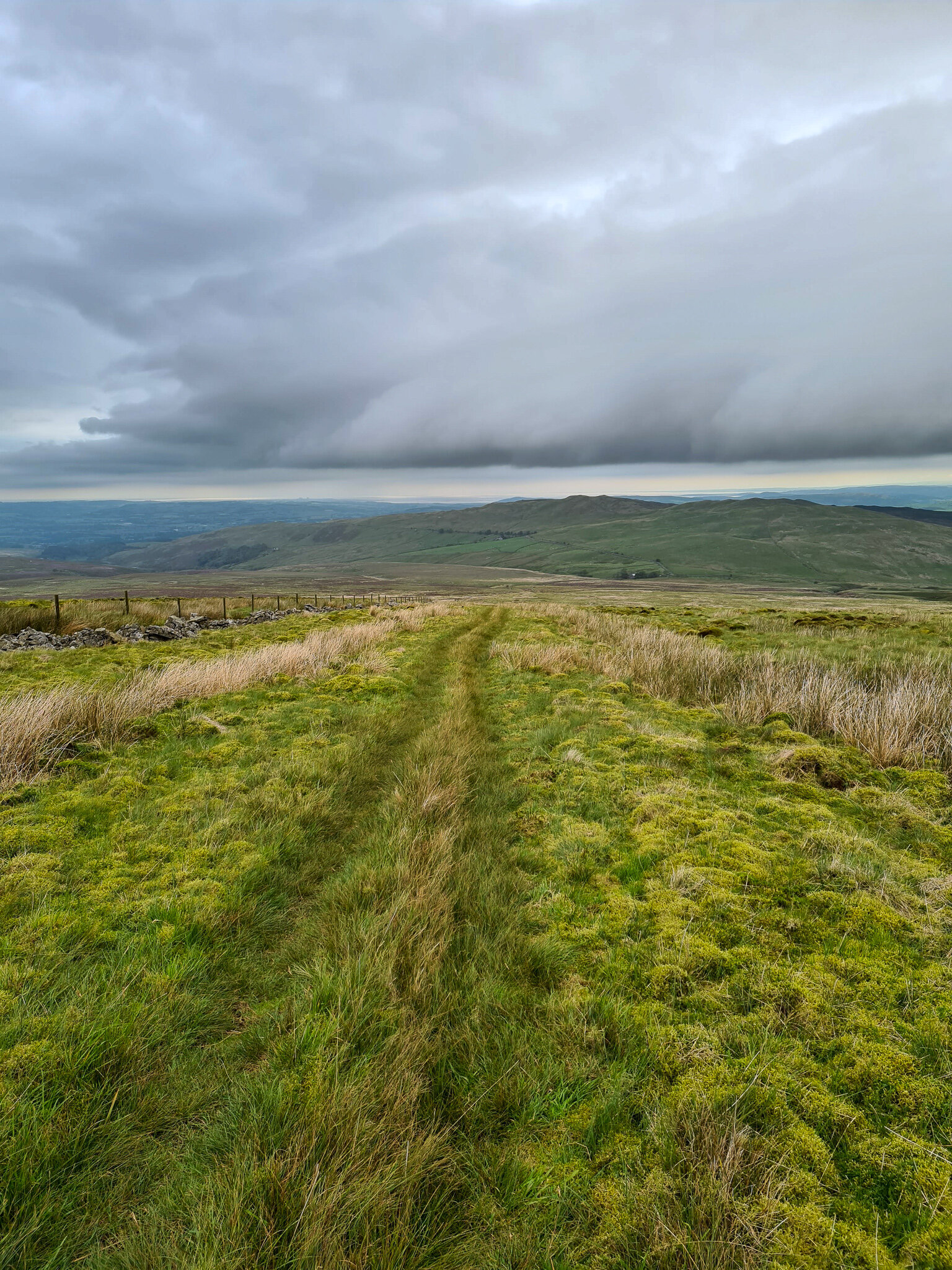
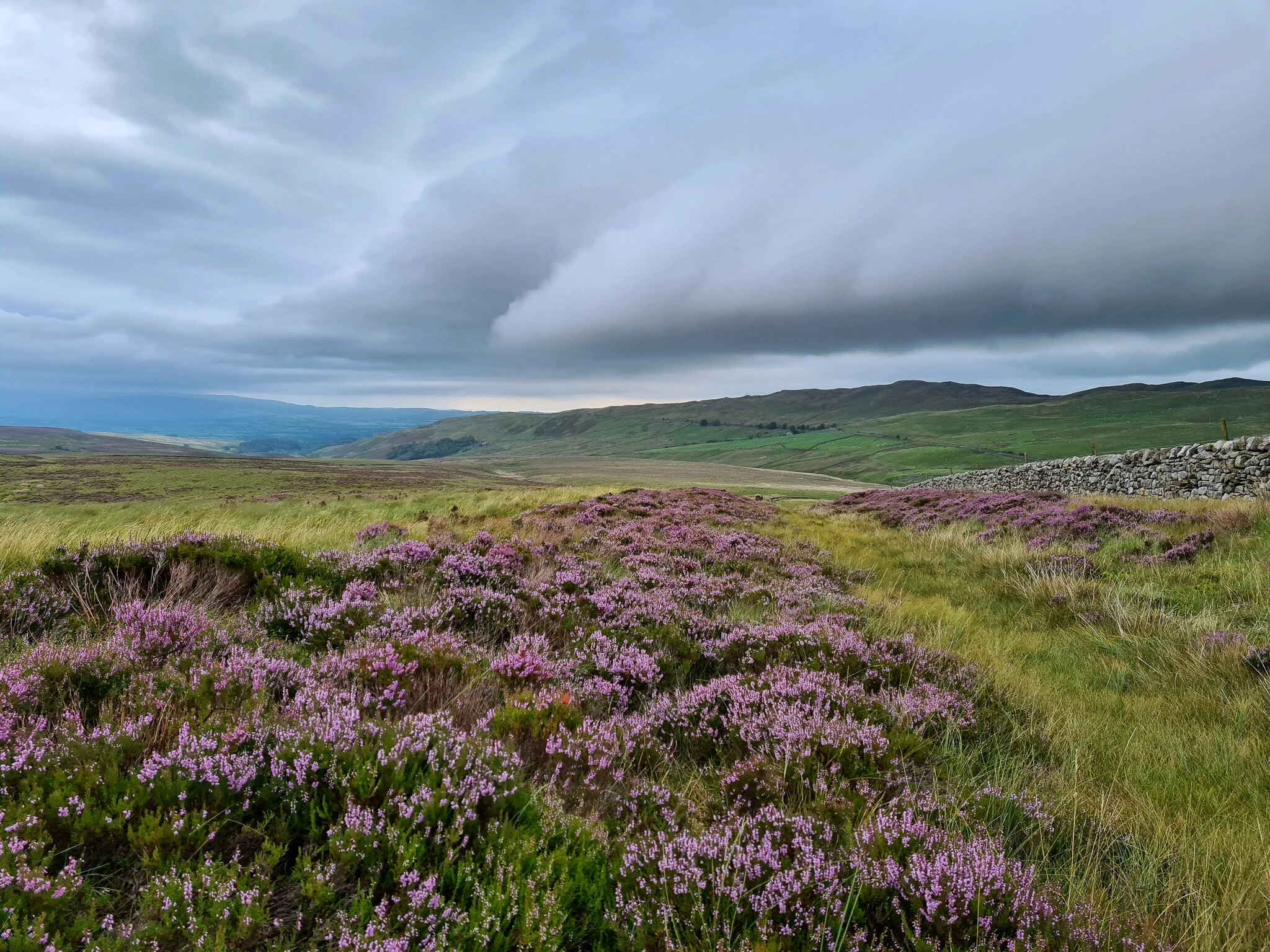
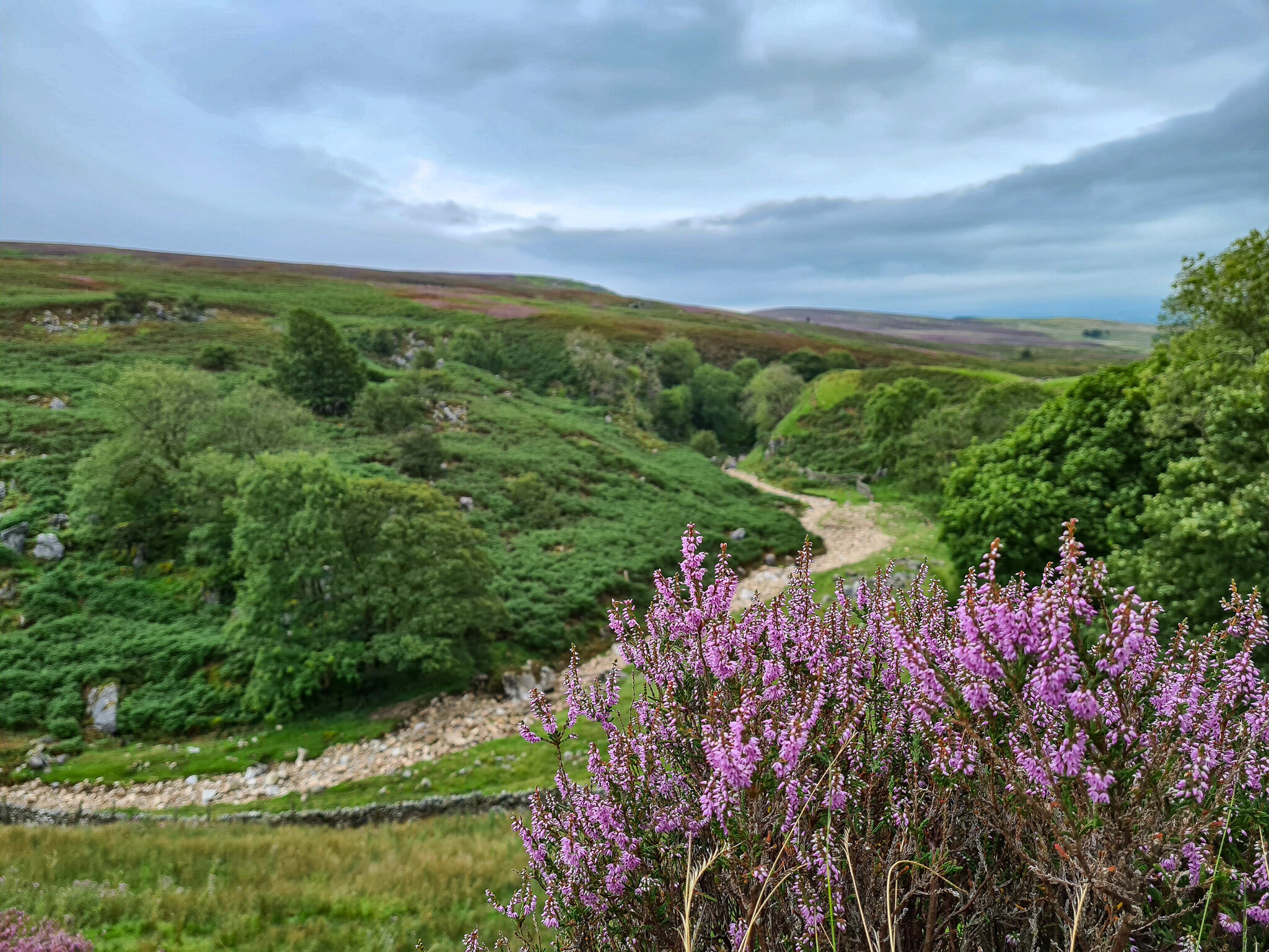
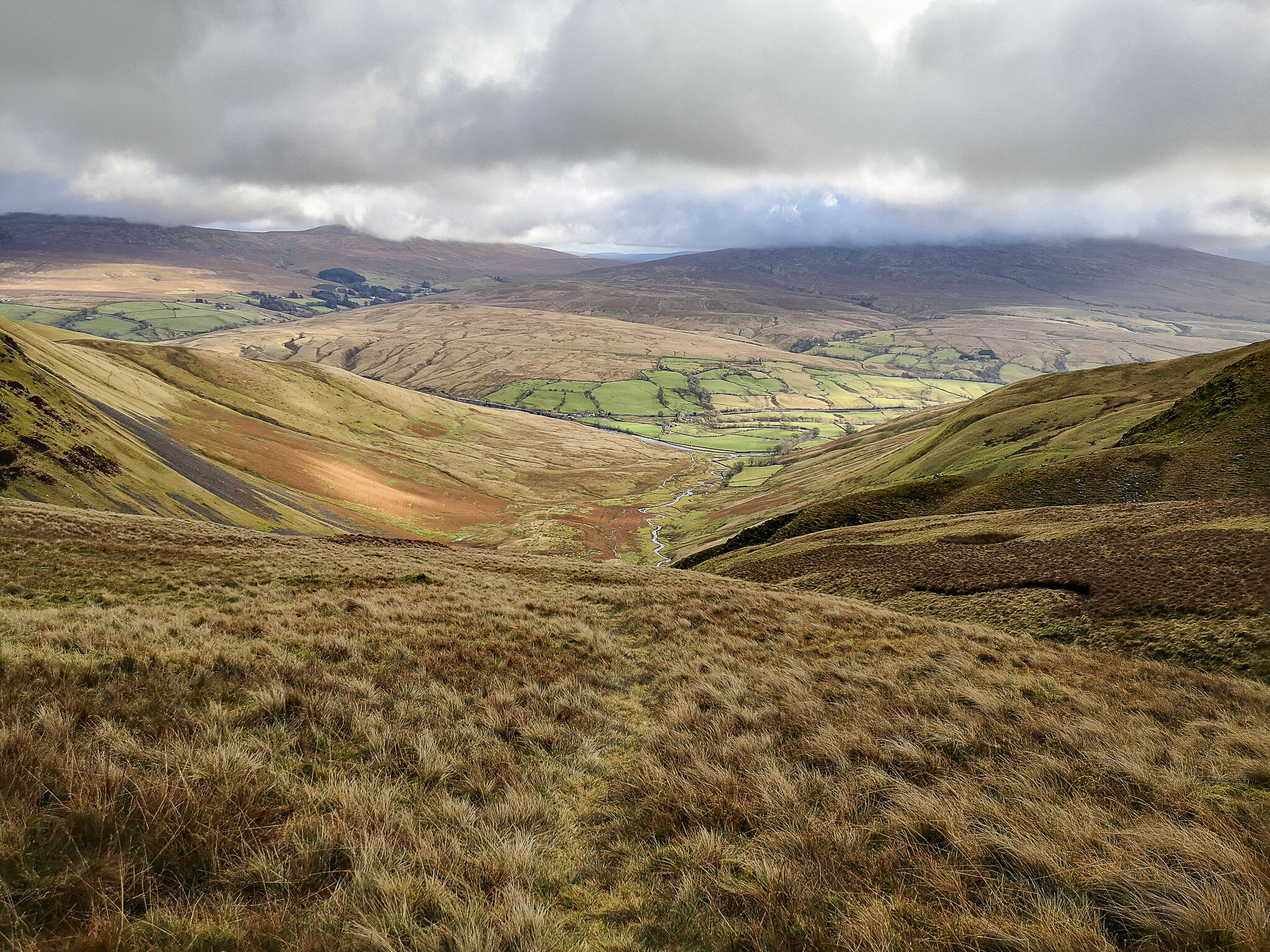
Planted in the heart of the Yorkshire Dales in the North of England, Upper Wharfedale is a u-shape valley that follows the River Wharfe along quiet villages such as Buckden, Yokenthwaite, Hubberholme, Littondale, Kettlewell, Starbotton and Langstrothdale to name a few. On offer, you will be sure to find stunning views of the areas that is characterised by its dry-stone walls and limestone outcrops with plenty of wildlife roaming the area. It is one of the quieter and more remote part of the Dales as demonstrated in the below photographs.
The hike begins from one of the towns nestled in the valley floor, although it doesn’t matter which town due it being a circular walk. Ideally, I would recommend starting from Buckden , as you can encounter the steepest part of the walk whilst you are fresh.


We began the hike from Buckden. The path off the main road is well sign posted throughout the Dale’s floor, before it quickly became very steep as we climbed up to the first summit of the day; immersing ourselves in the surrounding, exposed, hidden moorland valley. The climb seemed to go on for what seemed like an eternity. The terrain was ever changing and had a mix of boggy and shaley rock conditions “I’m going to stop for a Banana” Fuelled; we popped up at the top of the summit onto an excellent track, that followed some of Yorkshires iconic dry stone walls offering 360 views of mysterious fells in the distance, that were covered with haze and fog as we descended steeply into Litton.


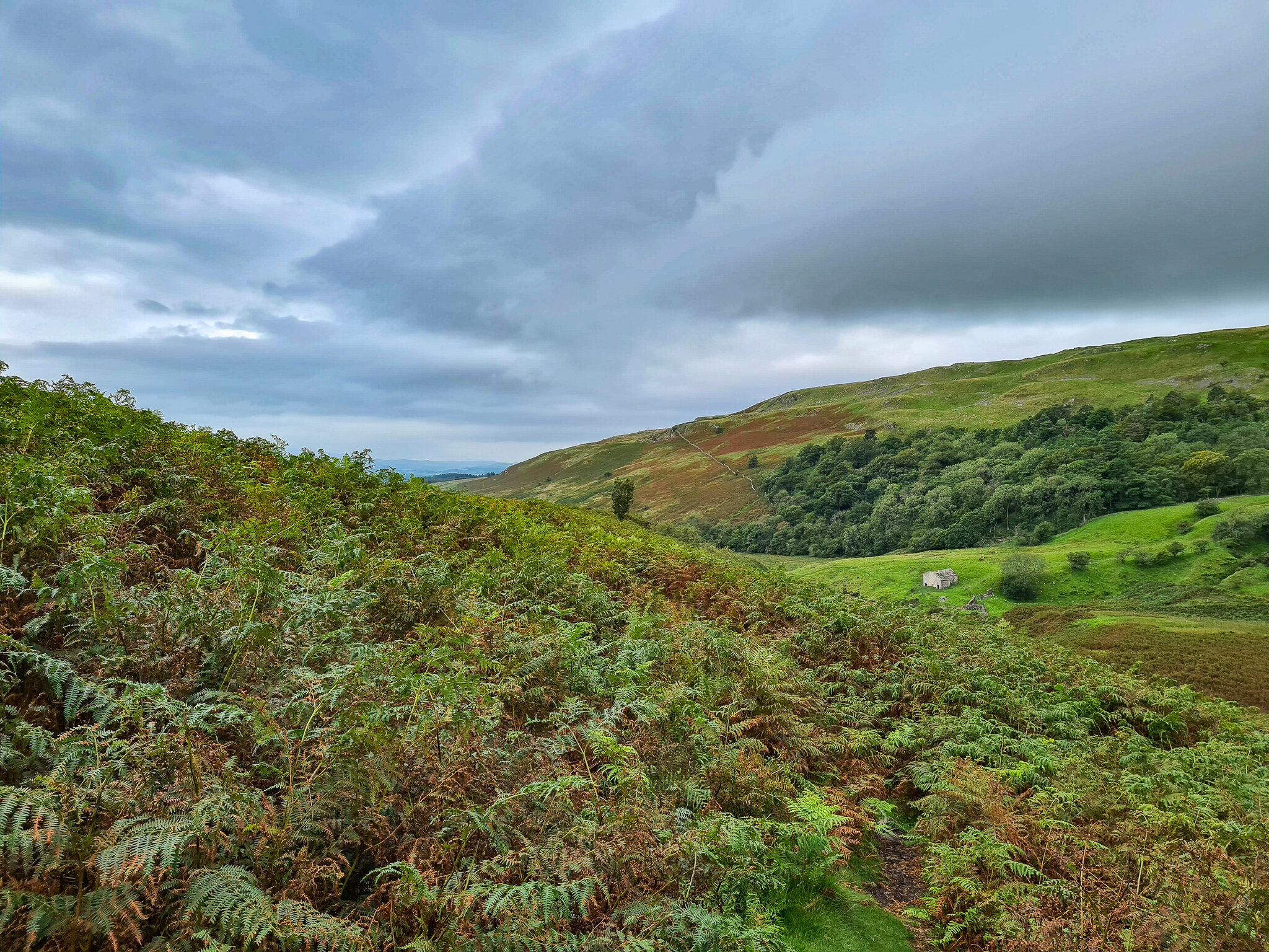
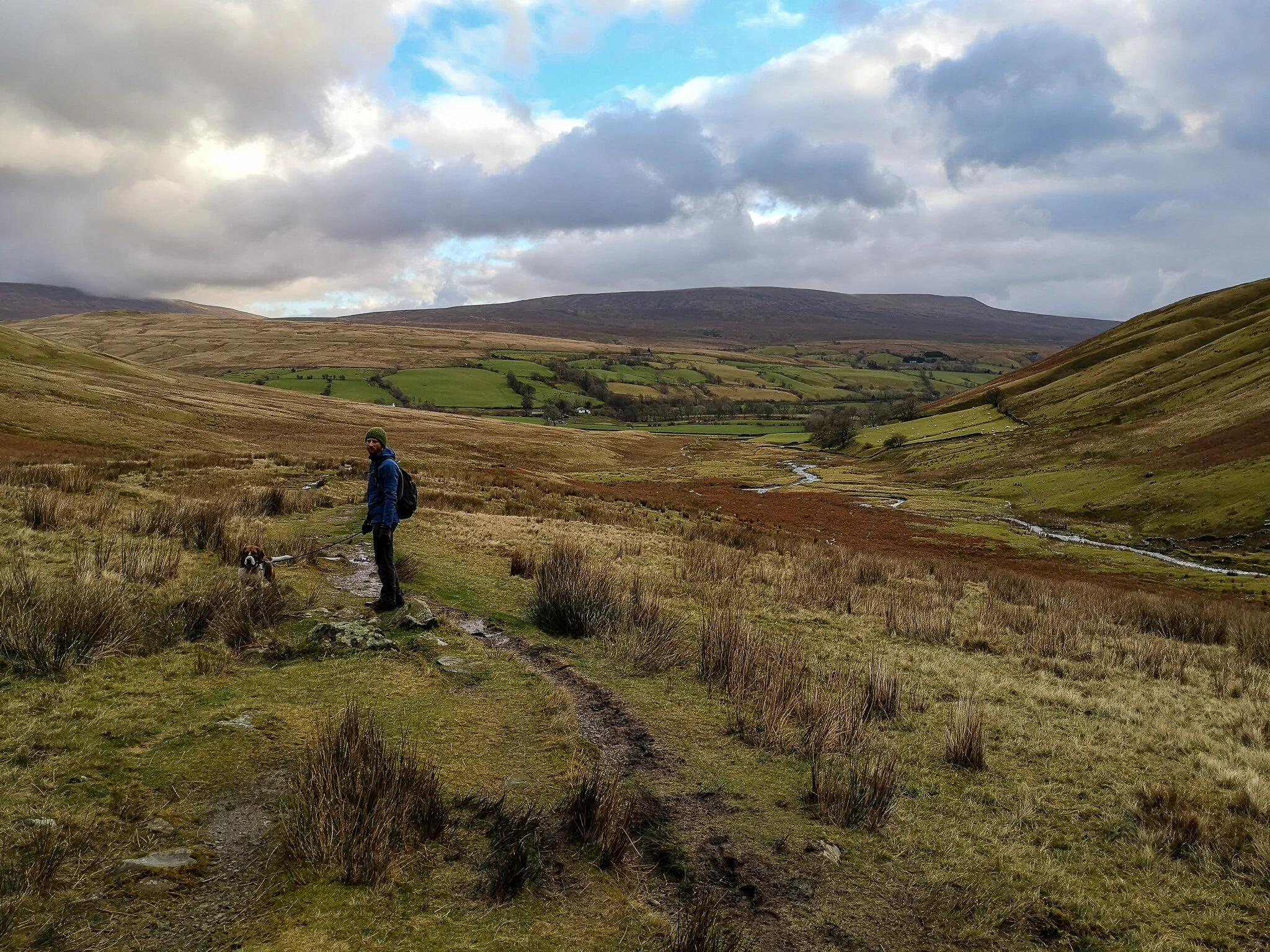
Once at the foot of the peaceful valley floor, we continued onwards towards Halton Gill on flat farmland fields that offered ruins of dilapidated but characteristic barns along the way. It was the perfect time to perch ourselves on the old rock as we admired the unique Dales surrounding us.


It wasn’t long after lunch we set foot on the bottom of climb number two, which was steeper and longer; however, we had company of roaming highland cattle that weren’t shy around humans. As we ascended higher to the summit of Horse Head, the views into the valley below gave a much greater perspective of the scale of the distant fells. The summit is vast, and quickly descends sharply into the quiet hamlet of Yokenthwaite that follows the gentle River Wharfe back to Buckden.
Although our time was coming to an end, leaving the beauty and simplicity that nature has to offer, I am left with an everlasting impression. Especially somewhere so close to home.

Great Coum, Green Hill & Crag Hill
15 miles / 24km
Location : Yorkshire Dales
A horseshoe ridgewalk
Great Coum, Green Hill & Grag Hill are neighbouring fells nestled in the Yorkshire dales that lie on the border of Cumbria. (Cumbrian Dales) This is a long ridge walk on uneven grassy terrain with panoramic views of distant fells; and on a clear day, you have views of the southern lakes, the Howgill Fells, Morecambe Bay, and the Yorkshire Three Peaks. Gragareth and Great Coum are also two of the Dales 30 Mountains.
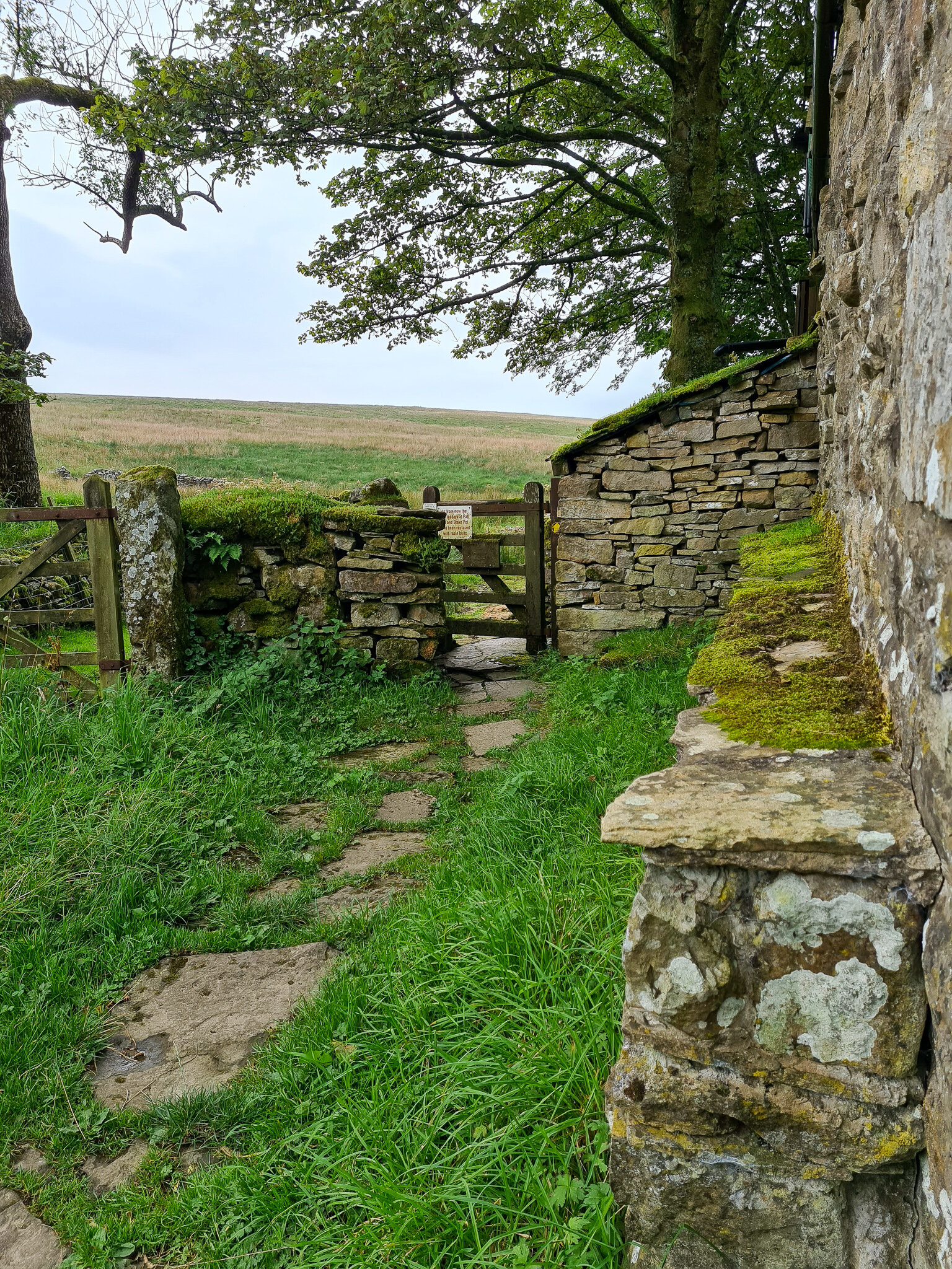
We began the hike from the small quaint town of Ireby that had your typical dales narrow country roads, which made it hard to find parking; however, we managed to find a spot by Leck House. As we began our walk on the lonely roads up to the fells we could see that the clouds were very low, so it was no doubt that we would be in clouds on most of the ridge.


Busy in mid-conversation, we could see ahead of us a lonely sheep struggling to free itself from the wire mesh. It appeared that it was a ram that had its curved horn caught in the mesh. I jumped over into the field and picked up the sheep (SHEEP ARE WELL HEAVY) whilst my friend helped untangle its horn. No idea how long the sheep was there for but I was covered in its poo! Yak! We managed to free the ram, and as I put it back on the ground we watched it run into the distance. It definitely boosted our morale for the rest of the day!
The worst part of the hike is probably walking on the road before it veers off to the right onto the grassy path that heads up towards the ridge. Some mysterious views of the low cloud on the hills were in the distance as we entered the white mist above. It felt very eerie, spooky, and extremely quiet! We couldn’t see anything past a couple of meters in front of us. I remember sitting down, having some lunch, and my friend turned to me and said “shh, stop chewing. Listen to how quiet it is?” It was a surreal moment and makes you realise how much noise pollution there is in the world.


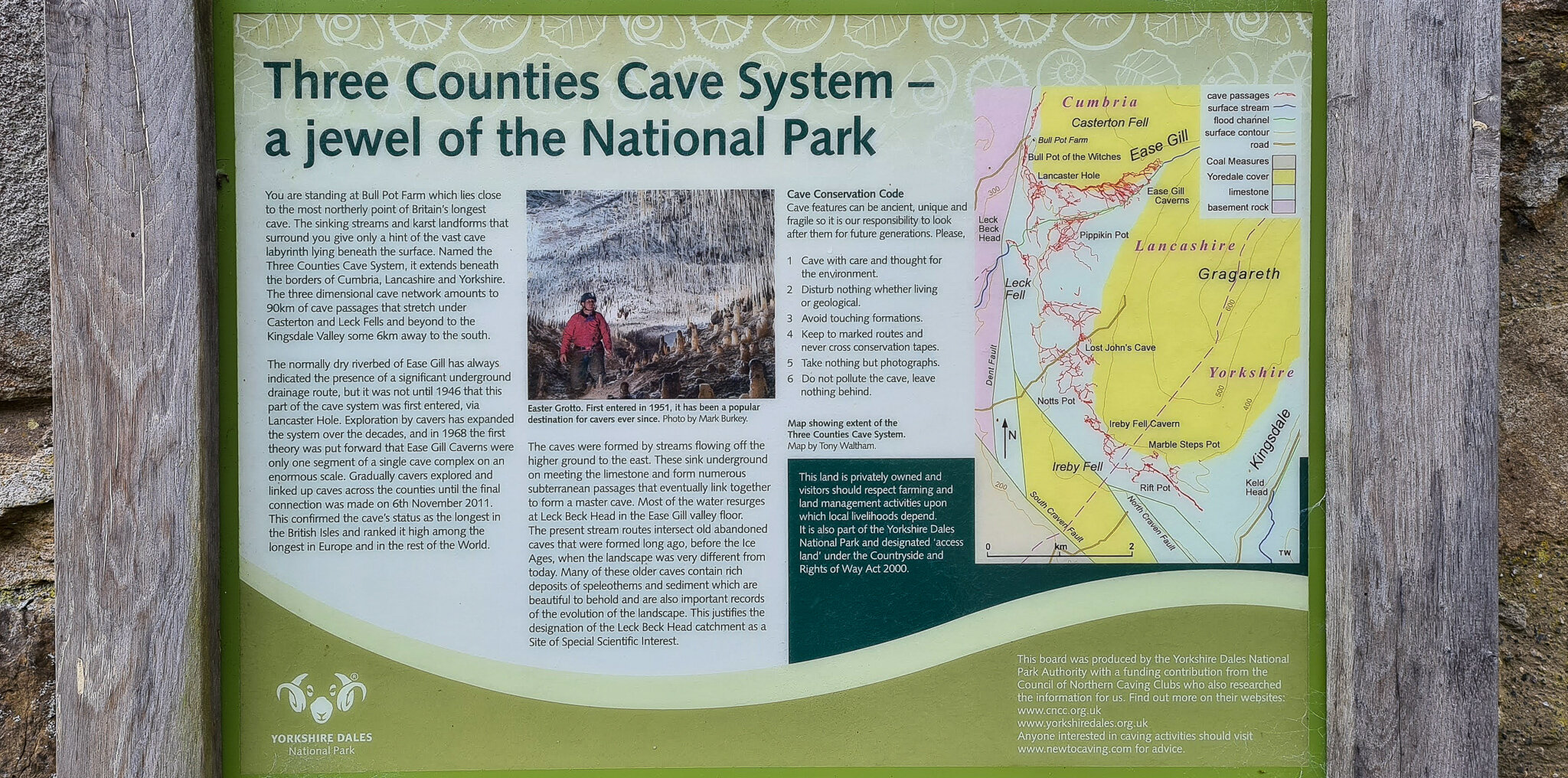
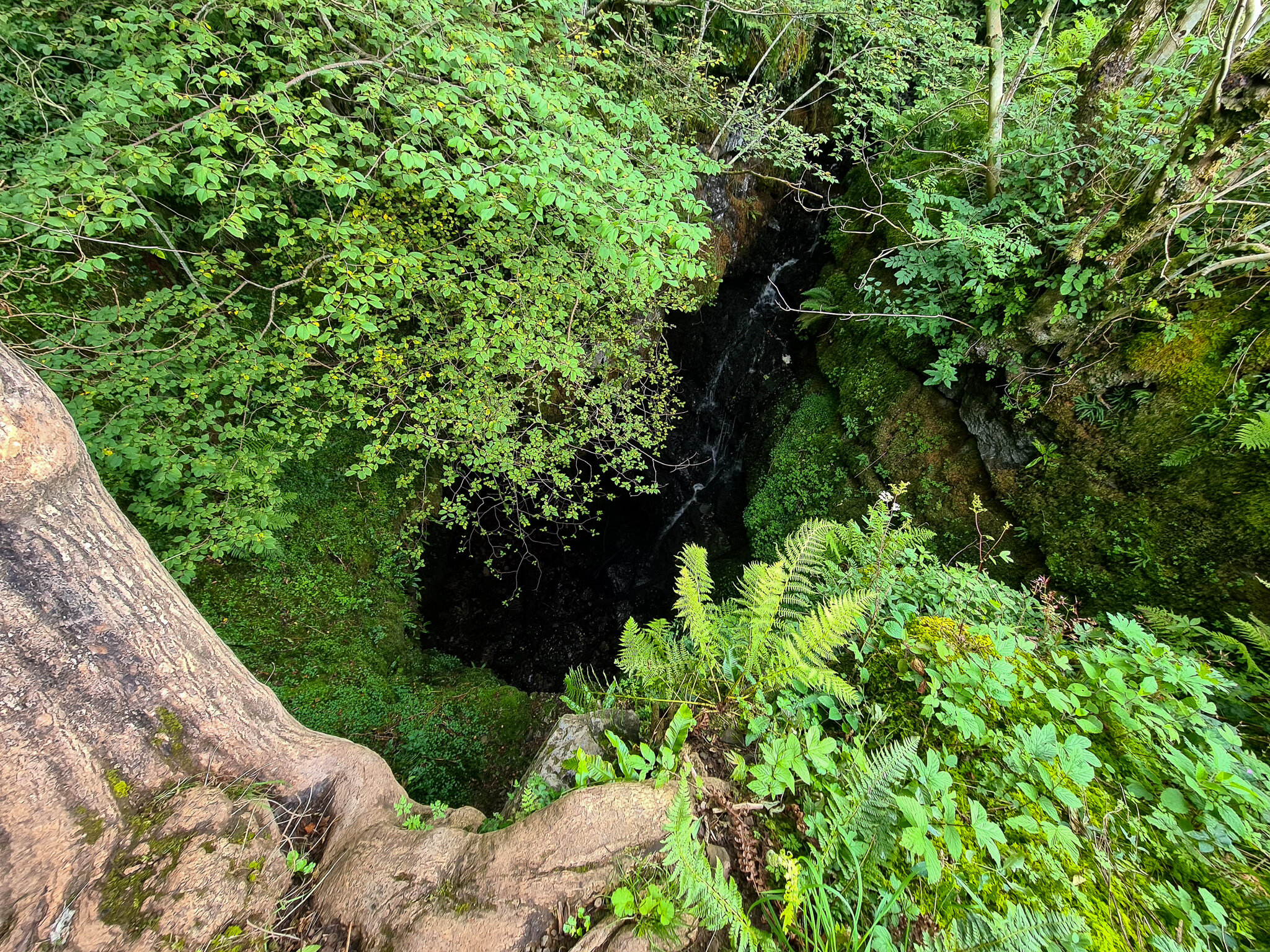
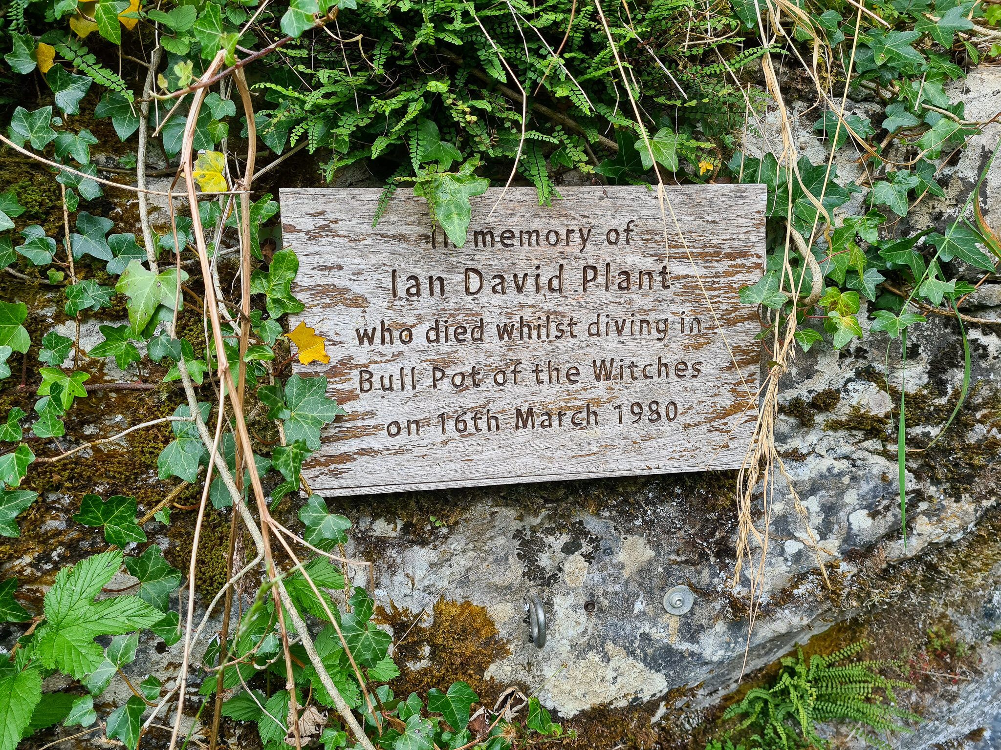
Onwards after lunch, we descended out of the clouds to the bottom of the valley. Following this, we past a landmark of a caving system that can be found under the ground beneath us, this is one of the biggest caving systems in the UK - an interesting and an unexpected find! Following this we winded through the almost jungle landscape to Leck Beck which was another un-expected find to the route, with deep shake holes and big gorge faces overpowering us. It was a great end to the hike as we slowly descended back to Ireby.
This is a very long walk and to be not underestimated!

Great Shunner fell & lovely seat
11 miles / 18 km
Location: North Yorkshire Dales
The third highest mountain in the Yorkshire Dales
Located on the north side of the Yorkshire Dales just off Hawes in a small town called Hardraw. I parked on a lay-by near the Hardraw sign. Here I began the walk which was on a clear well maintained path that headed towards Cotterdale. It was a sunny wintery day, blue skies, light winds and views for miles and miles of rolling distant fells. The path up to Great Shunner Fell is easy to follow due to well displayed cairns , past that it becomes a bit tricky and less visible and you might end up walking through marshy conditions, which makes it hard underfoot towards lovely seat and down to the bottom of buttertups pass. The seat wasn’t that Lovely when I got there, however on a good day this might have been a different case. If you are not used to walking in these conditions you might end losing your foot a couple of times through the marshlands (which I did) and takes a bit longer to navigate your way through. However, this is a great walk if you are looking solitude.
Distance: 11 miles / 18 km
Max Elevation: 2,230 feet / 680 metres


Yorkshire three peaks
24.5 miles / 39. 5 km.
This is a challenging hike over Yorkshires three highest peaks.
Location: Yorkshire Dales
Climbing Pen-y-Ghent, Ingleborough & Whernside in a single day
The Yorkshire three peaks is an Iconic walk that is on a lot of people’s bucket lists to complete. It is a 24.5-mile hike that covers all three of Yorkshires highest peaks in one day, these include Pen-y-Ghent, Whernside and Ingleborough.
It was the middle of summer and me and friend decided on attempting the three peaks. We have heard lots about the challenge but we were keen to try it out for ourselves. They say to attempt the walk in under 12 hours.
Up at 5am and out of the door at 6am we headed to Horton-in-Ribblesdale where you can park behind the Golden Lion hotel. It is £2 to park all day. There were already lots of people here to hike the three peaks as it is very popular, especially when it is good weather. The route is well sign posted and due to the volume of people trying to complete the challenge you just follow everyone else. The first peak was Pen-y-gent which was a steep climb that opened up the lungs you could say, we did go up there a bit fast though! and because it was still early, we got some great views as the sun was rising.
As we descended from pen-y-gent the hike takes you through the middle of the dales on well pathed paths until you hit a road that takes you to Ribblehead viaduct. This is the start of the climb up to Whernside, which is one of the easiest walks out of the three. It is a steady gradient so it doesn’t take it out of your legs too much. I like how open Whernside is and the simplicity of it. It is also a good spot to stop for lunch and refuel before heading to Ingleborough for the last leg, although you should try and drink regularly and eat something every hour. It definitely helps.
My friend at the time was suffering from an old knee injury, so he had to abandoned the last part of the hike. I was disappointed for him to say the least but I had to soldier on up Ingleborough so then he could be picked up. The last part of this walk is definitely the hardest as the gradient is very steep and you’re scrambling in some parts to the summit. My toes were killing me! I was wearing shoes that were too small for me, this didn’t help due to the terrain. Once at the top it is all downhill back to the car park. This where you really feel every ache and pain! in my case it was my toes and the back of my legs. I was almost crawling back in agony with my feet, but happy to have completed the challenge in just under 9 hours.
If you are thinking about hiking the three peaks, I would make sure you have the correct foot wear, giving your feet plenty of room. lots of electrolytes and plenty of energy food. I’d try out a few peaks beforehand too just to get used to the distance and gradients.
Distance: 24.5 miles / 39. 5 km
Max Elevation: 2,375ft / 723.9 metres


Great Knoutberry
8 miles / 12 km Easy walk
Location: Yorkshire Dales
Enjoy great views of the western fells
It was the start of 2019 and we decided to bring in the new year with a peaceful walk in the Yorkshire Dales. We were very lucky with the weather as it was content sunshine all day!
We parked up in stone house before Dent, just below the viaduct where the path starts. The climb is a gradual incline up Arten gill lane before turning left through a field up to the Summit of Great Knoutberry hill. It is a fairly short walk but the views do not disappoint over the western dales. Past the summit it is peaceful gradual rolling hills though moorlands. We didn’t see a single person all day. It is the perfect place to go to get away from it all, or in our case bring in the new year. On the decent is mainly road down into Dent past the railway (which we had lunch in station - a moment i will always remember) As the tarmac is smooth so it doesn’t talk too much out of your legs either so once we arrived at the bottom you follow the river back to Stone house.
Fairly moderate walk.
Distance - 8 miles / 12 km
Max Elevation - 2,205 ft / 672 metres
The Calf
12 miles / 19km hill walk.
Location: Cumbria
Enjoy deep valleys overlooking vast expanses of upland moorlands
Starting from Sedburgh on the border of the Yorkshire Dales in Cumbria, this is a hike that entails a day out meandering through the rolling hills of the Howgills fells. There is plenty of parking in Sedbergh where you can start your hike, up onto Howgill Lane and through Lockbank Farm and onto the steep grassy paths up to Winder peak and the Calf (trig point). We were a bit lost after the Calf due to fog and poor visibility where we ended up into an uknown valley looking towards Yarlside, which wasn’t part of the route, however, I am glad we made the detour as the valley was incredible and the perfect sport for some lunch. The Howgills are a great place for some easy walking alsong rolling hills, and miles of grassy terrain. On the hike, because you climb quite high in a relatively short period of time, the decent through Cautley spout is another incredible view if you catch it on a clear day. This looks out over the Howgills and down into Sedbergh and you can follow a path back into Sedbergh.
This is a challenging and lumpy walk if you are not used to the terrain.
Distance: 12 miles / 19 km
Max Elevation: 1,955 feet 596 metres


Buckden Pike
8 miles / 12km
Location: Yorkshire Dales
One of the highest fells in the Yorkshire Dales
The hike provides fantastic views along Wharfedale, scaling the height of Buckden Pike, passing an iconic memorial to some Polish pilots who were killed in a plane crash during World War II. Upon arrival there is a pub car park in buckden at the foot of the hike, that I parked in free of charge. Or if you are willing to pay, there is also a paid car park 100 metres from the pub.
From the car park I headed towards the steep stoney path, with views of the path carved into the landscape. Once at the top I tuned left through a gate and headed right onto well a maintained path, which heads onto the summit of the pike. (It is only a short walk to the summit, but be preapred for steep ascending) Upon arrival, I didn’t realise how windy it would be on the tops. I’ve never experienced anything like it before! Be prepared to shelter if you are caught out like I was, it was awful I had to shelter behind a wall on the summit away from the wind so I could eat my lunch. Luckily, I was rewarded with views over Walden head, admiring the rolling landscape. From there, I headed back down the valley towards Buckden, following the well maintained path that rewarded me with rays of sunshine that shone over the u-shape valley of Starbottom. On the valley floor, I followed the path besides the river bank enjoying the tranquility of the flowing water.
Distance: 8 miles / 12km
Max Elevation: 2,303 ft / 702 metres


